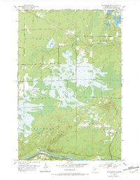
1953 Map of Brookston NW
USGS Topo · Published 1984About this map
The St. Louis River defines the southern boundary of this northern Minnesota landscape, where the Fond Du Lac Indian Reservation meets the townships of Ness, Alborn, Arrowhead, and Culver. This early 1950s survey shows a region dominated by intricate water systems and wetlands, characterized by Spider Creek and a cluster of inland bodies including Aerie Lake, Round Lake, and Muskrat Lake. The Great Northern railroad tracks parallel the river in the south, providing the primary industrial artery for the area. Local civic life is marked by the central Town Hall, while a Gravel Pit near Spider Lake indicates the small-scale resource extraction typical of the rural St. Louis County interior during this era.
Find a feature on this map
18 named features on this map. Tap any name to fly to it.
Don’t see what you’re looking for? This feature index may not catch every label — zoom into the map to look around manually.
Map Details
Editions of this 1953 Brookston NW Map
4 editions found
Other maps of this area

1953 · Payne
USGS Topo · 1:24,000

1953 · Alborn
USGS Topo · 1:24,000

1953 · Brookston
USGS Topo · 1:24,000

1953 · Brookston NW
USGS Topo · 1:24,000

1953 · Duluth
USGS Topo · 1:250,000

1954 · Martin Lake
USGS Topo · 1:24,000

1954 · Hibbing
USGS Topo · 1:250,000

1957 · Hibbing
USGS Topo · 1:250,000

1958 · Hibbing
USGS Topo · 1:250,000

1958 · Duluth
USGS Topo · 1:250,000