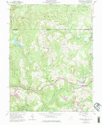
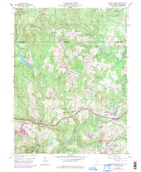
1960 Map of Bruceton Mills
USGS Topo · Published 1978About this map
Big Sandy Creek winds through the heart of this Preston County landscape, anchoring a rural industrial and agricultural corridor during the mid-to-late 20th century. The village of Bruceton Mills stands at a primary crossing, while the nearby settlement of Brandonville marks the eastern edge of the survey. The geography reveals a legacy of local industry, from the historical Old Valley Furnace in the northwest to more modern Strip Mine operations and a Quarry near the creek banks.
Find a feature on this map
37 named features on this map. Tap any name to fly to it.
Don’t see what you’re looking for? This feature index may not catch every label — zoom into the map to look around manually.
Map Details
Editions of this 1960 Bruceton Mills Map
5 editions found
Other maps of this area

1900 · Uniontown
USGS Topo · 1:62,500

1900 · Masontown
USGS Topo · 1:62,500

1902 · Morgantown
USGS Topo · 1:62,500

1903 · Masontown
USGS Topo · 1:62,500

1904 · Bruceton
USGS Topo · 1:62,500

1925 · Morgantown
USGS Topo · 1:62,500

1926 · Bruceton
USGS Topo · 1:62,500

1931 · Uniontown
USGS Topo · 1:62,500

1931 · Masontown
USGS Topo · 1:62,500

1931 · Bruceton Mills
USGS Topo · 1:62,500