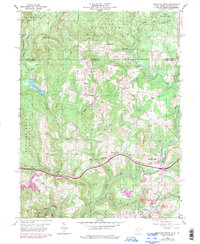
1960 Map of Bruceton Mills
USGS Topo · Published 1998About this map
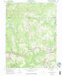
The community of Bruceton Mills serves as a focal point in this 1960 survey of northern Preston County, located just south of the Pennsylvania West Virginia state line. The landscape is defined by the winding course of Big Sandy Creek and the high elevation of Chestnut Ridge to the northwest. This era shows a mix of traditional Appalachian rural life and industrial transition, with the Old Valley Furnace marking earlier iron industry history while several Strip Mine operations appear further south.
Find a feature on this map
33 named features on this map. Tap any name to fly to it.
Don’t see what you’re looking for? This feature index may not catch every label — zoom into the map to look around manually.
Map Details
Editions of this 1960 Bruceton Mills Map
5 editions found
Other maps of this area

1900 · Uniontown
USGS Topo · 1:62,500

1900 · Masontown
USGS Topo · 1:62,500

1902 · Morgantown
USGS Topo · 1:62,500

1903 · Masontown
USGS Topo · 1:62,500

1904 · Bruceton
USGS Topo · 1:62,500

1925 · Morgantown
USGS Topo · 1:62,500

1926 · Bruceton
USGS Topo · 1:62,500

1931 · Uniontown
USGS Topo · 1:62,500

1931 · Masontown
USGS Topo · 1:62,500

1931 · Bruceton Mills
USGS Topo · 1:62,500