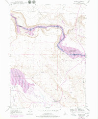
1947 Map of Bruneau
USGS Topo · Published 1978About this map
Bruneau sits at the southern edge of this Idaho landscape, where the Bruneau River Valley meets an intricate network of irrigation and historic transit routes. The geography is defined by the sharp descent from the surrounding plateaus into the canyon of the Snake River, now partially dominated by the C J Strike Reservoir. Traces of the region's pioneering history are evident in the path of the Emigrant Trail cutting across the central hills and the presence of several former community landmarks. To the west, the Little Valley Sch (Aban'd) and a Race Track (Aban'd) indicate shifts in local settlement and recreation. Agricultural development is clearly mapped through the Buckaroo Ditch and Little Valley Canal, which draw water into the arid valley to support the town and surrounding fields.
Find a feature on this map
19 named features on this map. Tap any name to fly to it.
Don’t see what you’re looking for? This feature index may not catch every label — zoom into the map to look around manually.
Map Details
Editions of this 1947 Bruneau Map
3 editions found
Other maps of this area

1892 · Mountain Home
USGS Topo · 1:125,000

1893 · Mountain Home
USGS Topo · 1:125,000

1946 · Mouth of Bruneau
USGS Topo · 1:24,000

1947 · Little Valley
USGS Topo · 1:24,000

1947 · Bruneau
USGS Topo · 1:62,500

1947 · Sand Dunes
USGS Topo · 1:24,000

1947 · Bruneau
USGS Topo · 1:24,000

1947 · Sugar Valley
USGS Topo · 1:24,000

1947 · Hot Spring
USGS Topo · 1:24,000

1948 · Sand Dunes
USGS Topo · 1:24,000