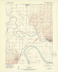
1951 Map of Brunswick West
USGS Topo · Published 1952About this map
The Missouri River and its major tributaries dictate the landscape in this early 1950s survey of the Carroll and Chariton county border. The area is defined by a complex network of levee systems protecting the low-lying bottomlands where the Grand River and Big Creek meet the Missouri. The confluence at Brunswick was a critical regional hub, supported by the Wabash railroad line and a river-based economy evident in features like the Wakenda Chute and a local Flood Gate.
Find a feature on this map
34 named features on this map. Tap any name to fly to it.
Don’t see what you’re looking for? This feature index may not catch every label — zoom into the map to look around manually.
Map Details
Editions of this 1951 Brunswick West Map
4 editions found

Other maps of this area

1890 · Marshall
USGS Topo · 1:125,000

1892 · Marshall
USGS Topo · 1:125,000

1901 · Marshall
USGS Topo · 1:125,000

1924 · Hale
USGS Topo · 1:62,500

1949 · Mendon
USGS Topo · 1:24,000

1949 · Indian Grove
USGS Topo · 1:24,000

1950 · Hale
USGS Topo · 1:24,000

1951 · Hale
USGS Topo · 1:24,000

1951 · Bosworth
USGS Topo · 1:24,000

1951 · Miami
USGS Topo · 1:24,000