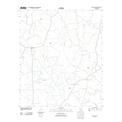
2012 Map of Bryceland
USGS Topo · Published 2012About this map
Driskill Mountain rises as a prominent landmark in this section of Bienville Parish, surrounded by a network of bayous and rural settlements. The village of Bryceland serves as a central hub, marked by its Po and a grid of local roads like Taylor Rd and Calhoun Rd. To the north, the community of Pratt and the Mount Gillard Cem indicate early local centers, while the southern reaches are defined by Jordan Mountain and the watercourse of Bear Creek. The landscape is heavily influenced by the winding path of Saline Bayou, which drains the timbered hills. For those tracing local history, the map provides precise locations for the Gentry Hill Lookout Tower and Holder Cem, reflecting the region's intersection of forest management and family heritage during the early 21st century.
Find a feature on this map
88 named features on this map. Tap any name to fly to it.
Don’t see what you’re looking for? This feature index may not catch every label — zoom into the map to look around manually.
Map Details
Editions of this 2012 Bryceland Map
This is the sole edition of this map. No revisions or reprints were ever made.
Other maps of this area

1947 · Bienville
USGS Topo · 1:62,500

1948 · Jamestown
USGS Topo · 1:62,500

1949 · Jamestown
USGS Topo · 1:62,500

1949 · Bienville
USGS Topo · 1:62,500

1949 · Gibsland
USGS Topo · 1:62,500

1950 · Gibsland
USGS Topo · 1:62,500

1950 · Arcadia
USGS Topo · 1:62,500

1951 · Arcadia
USGS Topo · 1:62,500

1955 · Shreveport
USGS Topo · 1:250,000

1956 · Shreveport
USGS Topo · 1:250,000