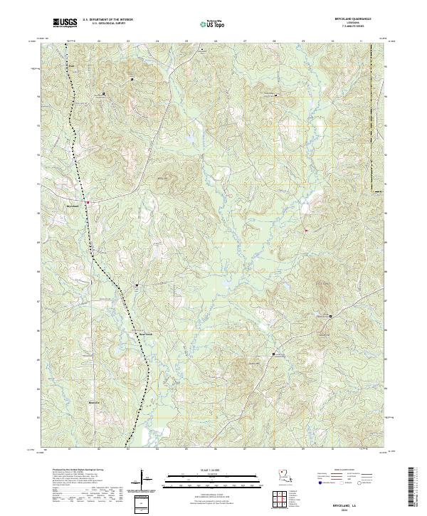
2024 Map of Bryceland
USGS Topo · Published 2024About this map
Driskill Mtn rises as a prominent landmark in this portion of Bienville Parish, surrounded by a landscape of winding watercourses and deeply rooted rural communities. The map documents the spatial relationship between settlements like Bryceland and Bienville, connected by a network of parish roads and highways that navigate the undulating terrain of Mossy Hill and Jordan Mtn. Numerous family and community landmarks are preserved here, including the Driskill Memorial Cem and the New Fellowship Church Cem, which serve as vital touchpoints for genealogical research.
Find a feature on this map
64 named features on this map. Tap any name to fly to it.
Don’t see what you’re looking for? This feature index may not catch every label — zoom into the map to look around manually.
Map Details
Editions of this 2024 Bryceland Map
This is the sole edition of this map. No revisions or reprints were ever made.
Other maps of this area

1947 · Bienville
USGS Topo · 1:62,500

1948 · Jamestown
USGS Topo · 1:62,500

1949 · Jamestown
USGS Topo · 1:62,500

1949 · Bienville
USGS Topo · 1:62,500

1949 · Gibsland
USGS Topo · 1:62,500

1950 · Gibsland
USGS Topo · 1:62,500

1950 · Arcadia
USGS Topo · 1:62,500

1951 · Arcadia
USGS Topo · 1:62,500

1955 · Shreveport
USGS Topo · 1:250,000

1956 · Shreveport
USGS Topo · 1:250,000