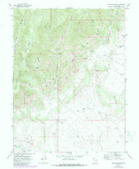
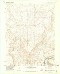
1970 Map of Bryson Canyon
USGS Topo · Published 1987About this map
San Arroyo Ridge and Bryson Ridge dominate this high-desert landscape in northeastern Grand County, where the topography is defined by deeply incised drainage systems and industrial extraction. The map reveals the extensive infrastructure of the Stateline Gas Field, a network of Gas Wells and Drill Holes connected by winding Jeep Trails that traverse the complex terrain between San Arroyo Canyon and Bitter Creek. This 1970s-era survey, updated in the late 1980s, documents a transition in land use as energy development integrated with traditional grazing, indicated by a lone Corral and numerous fence lines. Key landmarks like Hat Rock and Lion Bench provide orientation amidst the labyrinth of ephemeral waterways including Winter Camp Wash and Bryson Wash, illustrating the geologic character of the Cliffs and canyons that define this remote border region.
Find a feature on this map
23 named features on this map. Tap any name to fly to it.
Don’t see what you’re looking for? This feature index may not catch every label — zoom into the map to look around manually.
Map Details
Editions of this 1970 Bryson Canyon Map
2 editions found
Other maps of this area

1885 · East Tavaputs
USGS Topo · 1:250,000

1956 · Grand Junction
USGS Topo · 1:250,000

1959 · Grand Junction
USGS Topo · 1:250,000

1960 · Grand Junction
USGS Topo · 1:250,000

1962 · Grand Junction
USGS Topo · 1:250,000

1964 · Grand Junction
USGS Topo · 1:250,000

1965 · Grand Junction
USGS Topo · 1:250,000
1970 · Harley Dome
USGS Topo · 1:24,000
1970 · Bar X Wash
USGS Topo · 1:24,000
1970 · Bitter Creek Well
USGS Topo · 1:24,000