
1961 Map of Buck Mountain
USGS Topo · Published 1962About this map
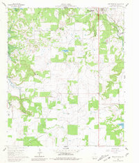
Breckenridge stands at the edge of a landscape undergoing a major hydrological transformation in the early 1960s. This survey by the State of Texas and the Texas Water Commission indicates significant areas of land along Hubbard Creek and Sandy Creek that were marked for controlled inundation to create Hubbard Creek Lake. The map serves as a final record of the original terrain before the waters rose, showing the precise locations of the Curry Oil Field and the Curry Pool Road which served the local petroleum industry. Small rural landmarks like Post Oak Cem and Hart Cem remain on higher ground, while the Chicago Rock Island and Pacific railroad line cuts through the northeast, passing by the Stephens County Airport.
Find a feature on this map
25 named features on this map. Tap any name to fly to it.
Don’t see what you’re looking for? This feature index may not catch every label — zoom into the map to look around manually.
Map Details
Editions of this 1961 Buck Mountain Map
3 editions found
Other maps of this area

1890 · Breckenridge
USGS Topo · 1:125,000

1892 · Albany
USGS Topo · 1:125,000

1893 · Albany
USGS Topo · 1:125,000

1954 · Abilene
USGS Topo · 1:250,000

1958 · Abilene
USGS Topo · 1:250,000

1958 · Breckenridge
USGS Topo · 1:24,000

1958 · Edwards Branch
USGS Topo · 1:24,000

1961 · Eolian
USGS Topo · 1:24,000

1965 · Indian Knoll
USGS Topo · 1:24,000
1967 · Wayland
USGS Topo · 1:24,000