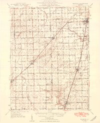
1949 Map of Buckley
USGS Topo · Published 1949About this map
The Illinois Central railroad corridor serves as the primary artery through this section of Ford and Iroquois counties, connecting the grain-loading settlements of Buckley, Onarga, Loda, and Roberts. The landscape is a textbook example of high-density rural school districts prior to mid-century consolidation, with dozens of family-named schoolhouses such as Wagner Sch, Fuoss Sch, and Zahn Sch spaced at nearly every mile. These structures, alongside landmarks like Pine Ridge Cem and Brewton Cem, provide a precise record of early prairie settlement patterns. The drainage network is defined by the North Fork Vermilion River and the East Branch Vermilion River, which dictated the early road placements and farm boundaries before the grid was fully established.
Find a feature on this map
49 named features on this map. Tap any name to fly to it.
Don’t see what you’re looking for? This feature index may not catch every label — zoom into the map to look around manually.
Map Details
Editions of this 1949 Buckley Map
2 editions found

Other maps of this area

1924 · Paxton
USGS Topo · 1:62,500

1927 · Paxton
USGS Topo · 1:62,500

1928 · Gibson City
USGS Topo · 1:62,500

1936 · Potomac
USGS Topo · 1:62,500

1939 · Cissna Park
USGS Topo · 1:62,500

1944 · Piper City
USGS Topo · 1:48,000

1944 · Gilman
USGS Topo · 1:62,500

1946 · Gilman
USGS Topo · 1:62,500

1947 · Piper City
USGS Topo · 1:62,500

1947 · Sibley
USGS Topo · 1:62,500