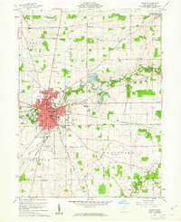
1960 Map of Bucyrus
USGS Topo · Published 1962About this map
Bucyrus serves as a significant central Ohio rail hub in this early 1960s study, where the Pennsylvania and New York Central lines intersect amidst a dense concentration of local institutions. The city is well-documented with municipal landmarks including the Courthouse, Hosp, and several neighborhood schools such as Norton Sch and Lincoln Sch. Beyond the urban core, the landscape transitions into the agricultural townships of Liberty and Whetstone, where family-named cemeteries like Rupp Cem and Campbell Cem offer valuable points of interest for genealogists.
Find a feature on this map
55 named features on this map. Tap any name to fly to it.
Don’t see what you’re looking for? This feature index may not catch every label — zoom into the map to look around manually.
Map Details
Editions of this 1960 Bucyrus Map
4 editions found
Other maps of this area

1903 · Marion
USGS Topo · 1:62,500

1905 · Marion
USGS Topo · 1:62,500

1906 · Sycamore
USGS Topo · 1:62,500

1913 · Mount Gilead
USGS Topo · 1:62,500

1915 · Bucyrus
USGS Topo · 1:62,500

1916 · Mount Gilead
USGS Topo · 1:62,500

1943 · Bucyrus
USGS Topo · 1:62,500

1943 · Mount Gilead
USGS Topo · 1:62,500

1950 · Marion
USGS Topo · 1:250,000

1960 · North Robinson
USGS Topo · 1:24,000