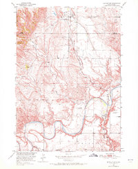
1950 Map of Buffalo Gap
USGS Topo · Published 1972About this map
The Cheyenne River snakes through the southern half of this landscape, its wide bends carving through the border between Custer and Fall River counties. This mid-century survey captures a rural environment defined by isolated schools and the vital transit corridor of the Chicago and North Western railroad. Along this rail line, the communities of Buffalo Gap and Oral serve as the primary hubs, with the former supported by the Buffalo Gap Cemetery to the south.
Find a feature on this map
19 named features on this map. Tap any name to fly to it.
Don’t see what you’re looking for? This feature index may not catch every label — zoom into the map to look around manually.
Map Details
Editions of this 1950 Buffalo Gap Map
3 editions found
Other maps of this area

1894 · Hermosa
USGS Topo · 1:125,000

1896 · Oelrichs
USGS Topo · 1:125,000

1900 · Oelrichs
USGS Topo · 1:125,000

1901 · Hermosa
USGS Topo · 1:125,000

1950 · Hot Springs
USGS Topo · 1:24,000

1950 · Buffalo Gap
USGS Topo · 1:24,000

1950 · Hot Springs SE
USGS Topo · 1:24,000

1950 · Angostura Reservoir
USGS Topo · 1:24,000

1951 · Smithwick NW
USGS Topo · 1:24,000

1955 · Hot Springs
USGS Topo · 1:250,000