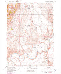
1950 Map of Buffalo Gap
USGS Topo · Published 1979About this map
The Cheyenne River winds through this South Dakota landscape, creating a dramatic series of meanders that define the local topography. At the northern edge of the map, the settlement of Buffalo Gap serves as a focal point near the Buffalo Gap Cem, while the town of Oral is situated to the southeast along the Chicago and North Western railroad line. The map illustrates a rural educational network that was already beginning to fade by the mid-century, specifically noting the Friedrick Sch (Abandoned) alongside active locations like Falls Sch and Fairview Sch.
Find a feature on this map
17 named features on this map. Tap any name to fly to it.
Don’t see what you’re looking for? This feature index may not catch every label — zoom into the map to look around manually.
Map Details
Editions of this 1950 Buffalo Gap Map
3 editions found
Other maps of this area

1894 · Hermosa
USGS Topo · 1:125,000

1896 · Oelrichs
USGS Topo · 1:125,000

1900 · Oelrichs
USGS Topo · 1:125,000

1901 · Hermosa
USGS Topo · 1:125,000

1950 · Hot Springs
USGS Topo · 1:24,000

1950 · Buffalo Gap
USGS Topo · 1:24,000

1950 · Hot Springs SE
USGS Topo · 1:24,000

1950 · Angostura Reservoir
USGS Topo · 1:24,000

1951 · Smithwick NW
USGS Topo · 1:24,000

1955 · Hot Springs
USGS Topo · 1:250,000