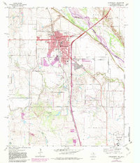
1972 Map of Burkburnett
USGS Topo · Published 1982About this map
The Red River corridor defines this borderland landscape, where the Missouri Kansas Texas railroad and several major highways converge. The community of Burkburnett serves as the primary hub, showing significant urban expansion into the 1970s and 1980s. A diverse mix of civic and industrial infrastructure is present, including a Fish Hatchery, Filtration Plant, and a specialized Sewage Disposal facility. To the south, the presence of Sheppard Air Force Base indicates the region's strategic military importance during the latter half of the twentieth century.
Find a feature on this map
43 named features on this map. Tap any name to fly to it.
Don’t see what you’re looking for? This feature index may not catch every label — zoom into the map to look around manually.
Map Details
Editions of this 1972 Burkburnett Map
3 editions found
Other maps of this area

1915 · Clara
USGS Topo · 1:24,000

1915 · Burkburnett
USGS Topo · 1:24,000

1916 · Iowa Park
USGS Topo · 1:24,000

1918 · Buckburnett
USGS Topo · 1:31,680

1918 · Clara
USGS Topo · 1:31,680

1918 · Iowa Park
USGS Topo · 1:31,680

1954 · Wichita Falls
USGS Topo · 1:250,000

1955 · Lawton
USGS Topo · 1:250,000

1957 · Wichita Falls West
USGS Topo · 1:24,000

1957 · Burkburnett
USGS Topo · 1:62,500