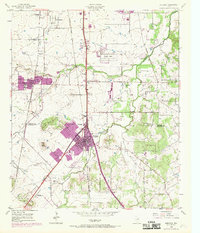
1955 Map of Burleson
USGS Topo · Published 1969About this map
The Tarrant Co Johnson Co boundary bisects this landscape, which in the mid-1950s was beginning to show the purple-tinted footprints of urban expansion from Fort Worth. Burleson serves as a primary hub, sitting at the junction of the Missouri Kansas Texas railroad and several arterial roads. Further north, Garden Acres and South Seminary mark the suburban fringe, while the western reaches include Crowley and the industrial activity of various Gravel Pits.
Find a feature on this map
35 named features on this map. Tap any name to fly to it.
Don’t see what you’re looking for? This feature index may not catch every label — zoom into the map to look around manually.
Map Details
Editions of this 1955 Burleson Map
4 editions found
Other maps of this area

1891 · Cleburne
USGS Topo · 1:125,000

1894 · Cleburne
USGS Topo · 1:125,000

1894 · Fort Worth
USGS Topo · 1:125,000

1954 · Dallas
USGS Topo · 1:250,000

1955 · Burleson
USGS Topo · 1:24,000

1955 · Primrose
USGS Topo · 1:24,000

1955 · Benbrook
USGS Topo · 1:24,000

1955 · Fort Worth
USGS Topo · 1:24,000

1958 · Dallas
USGS Topo · 1:250,000

1959 · Kennedale
USGS Topo · 1:24,000