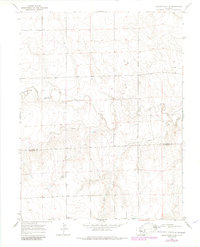
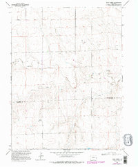
1969 Map of Burlington 3 SW
USGS Topo · Published 1985About this map
The high plains of eastern Colorado are defined here by the drainage network of the North Fork Smoky Hill River, which cuts across the terrain alongside seasonal watercourses like Caw Creek and Rock Creek. This 1969 field-checked landscape shows the sparse settlement pattern typical of the region, anchored by the Windrift Ranch in the southwestern portion of the quadrangle. Straddling the boundary between Kit Carson County and Cheyenne County, the map captures the transition from open grazing land to infrastructure development, most notably marked by a prominent Pipeline traversing the eastern sections. Numerous wells dot the map, indicating the importance of subterranean water access for cattle ranching and domestic use in this semi-arid environment.
Find a feature on this map
7 named features on this map. Tap any name to fly to it.
Don’t see what you’re looking for? This feature index may not catch every label — zoom into the map to look around manually.
Map Details
Editions of this 1969 Burlington 3 SW Map
5 editions found
Other maps of this area

1891 · Kit Carson
USGS Topo · 1:125,000

1892 · Cheyenne Wells
USGS Topo · 1:125,000

1893 · Kit Carson
USGS Topo · 1:125,000

1894 · Cheyenne Wells
USGS Topo · 1:125,000

1954 · Limon
USGS Topo · 1:250,000

1954 · Lamar
USGS Topo · 1:250,000

1957 · Limon
USGS Topo · 1:250,000

1958 · Limon
USGS Topo · 1:250,000

1958 · Lamar
USGS Topo · 1:250,000

1969 · Alpine Ranch NE
USGS Topo · 1:24,000