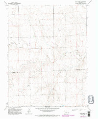
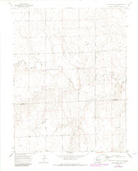
1969 Map of Rock Creek
USGS Topo · Published 1995About this map
The North Fork Smoky Hill River flows through this high plains landscape on the eastern Colorado border, marking a region defined by its sparse drainage patterns and ranching heritage. The map documents the boundary between Kit Carson and Cheyenne counties, where the terrain is etched by seasonal watercourses like Cow Creek and the eponymous Rock Creek. These waterways, often dry in this semi-arid environment, dictated the placement of early infrastructure and isolated outposts such as the Windrift Ranch.
Find a feature on this map
8 named features on this map. Tap any name to fly to it.
Don’t see what you’re looking for? This feature index may not catch every label — zoom into the map to look around manually.
Map Details
Editions of this 1969 Rock Creek Map
5 editions found
Other maps of this area

1891 · Kit Carson
USGS Topo · 1:125,000

1892 · Cheyenne Wells
USGS Topo · 1:125,000

1893 · Kit Carson
USGS Topo · 1:125,000

1894 · Cheyenne Wells
USGS Topo · 1:125,000

1954 · Limon
USGS Topo · 1:250,000

1954 · Lamar
USGS Topo · 1:250,000

1957 · Limon
USGS Topo · 1:250,000

1958 · Limon
USGS Topo · 1:250,000

1958 · Lamar
USGS Topo · 1:250,000

1969 · Alpine Ranch NE
USGS Topo · 1:24,000