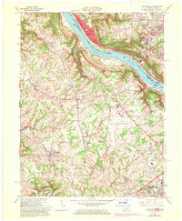
1961 Map of Burlington
USGS Topo · Published 1970About this map
Greater Cincinnati Airport dominates the central plateau of this northern Kentucky landscape, serving as a mid-century focal point between the established settlement of Burlington and the Ohio River. The transition from agrarian roots to suburban aviation hub is evident, with traditional family burial sites like Watts Cem and Hebron Cem remaining near the expanding airport infrastructure. Along the northern border, the Ohio River facilitates heavy transport via the Baltimore and Ohio Railroad and Penn Central tracks, while the historic Anderson Ferry continues to link the riverbanks. The map documents several educational and religious institutions, including the Seminary of Pius X and Immaculate Heart of Mary Sch, reflecting the community's mid-century growth. To the southeast, the Latonia Racetrack and Florence represent the early expansion of the Cincinnati metropolitan area into Boone County.
Find a feature on this map
57 named features on this map. Tap any name to fly to it.
Don’t see what you’re looking for? This feature index may not catch every label — zoom into the map to look around manually.
Map Details
Editions of this 1961 Burlington Map
3 editions found
Other maps of this area

1914 · West Cincinnati
USGS Topo · 1:62,500

1915 · Lawrenceburg
USGS Topo · 1:48,000

1928 · Lawrenceburg
USGS Topo · 1:62,500

1932 · Lawrenceburg
USGS Topo · 1:62,500

1943 · Rising Sun
USGS Topo · 1:24,000

1943 · Hooven
USGS Topo · 1:24,000

1943 · Lawrenceburg
USGS Topo · 1:24,000

1950 · Union
USGS Topo · 1:24,000

1950 · Independence
USGS Topo · 1:24,000

1950 · Covington
USGS Topo · 1:24,000