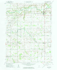
1961 Map of Burlington
USGS Topo · Published 1962About this map
Burlington anchors the northeast corner of this central Indiana landscape, situated along the winding course of Wildcat Creek. The 1961 survey documents a rural environment defined by a grid of section lines and township boundaries, including Democrat, Burlington, Owen, and Warren. Small farming communities like Lexington and Geetingsville punctuate the landscape, preserving the historical settlement patterns of Carroll and Clinton Counties.
Find a feature on this map
31 named features on this map. Tap any name to fly to it.
Don’t see what you’re looking for? This feature index may not catch every label — zoom into the map to look around manually.
Map Details
Editions of this 1961 Burlington Map
3 editions found
Other maps of this area

1953 · Danville
USGS Topo · 1:250,000

1955 · Danville
USGS Topo · 1:250,000

1956 · Danville
USGS Topo · 1:250,000

1959 · Young America
USGS Topo · 1:24,000

1961 · Michigantown
USGS Topo · 1:24,000

1961 · Russiaville
USGS Topo · 1:24,000

1961 · Hillisburg
USGS Topo · 1:24,000

1961 · Rossville
USGS Topo · 1:24,000

1961 · Burlington
USGS Topo · 1:24,000

1961 · Frankfort
USGS Topo · 1:24,000