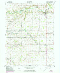
1961 Map of Burlington
USGS Topo · Published 1984About this map
Wildcat Creek meanders through the northern portion of this landscape, defining the rural character of the border between Carroll and Clinton Counties. The settlement of Burlington sits at a prominent bend in the creek, serving as a local hub near several dispersed crossroads communities such as Geetingsville, Lexington, and Middlefork. This 1961 field-checked survey reveals a stable agricultural environment where social life is anchored by traditional landmarks like Ball Hill Ch and the Township Sch. Drainage across the fertile plains is managed by a network of engineered waterways, including Biery Ditch and Whiteman Ditch, illustrating the intensive land use required for Indiana's mid-century farming economy. Genealogists will find a high density of burial sites throughout the townships of Democrat, Owen, and Warren, ranging from Old Charity Cem in the south to Asbury Cem in the north.
Find a feature on this map
31 named features on this map. Tap any name to fly to it.
Don’t see what you’re looking for? This feature index may not catch every label — zoom into the map to look around manually.
Map Details
Editions of this 1961 Burlington Map
3 editions found
Other maps of this area

1953 · Danville
USGS Topo · 1:250,000

1955 · Danville
USGS Topo · 1:250,000

1956 · Danville
USGS Topo · 1:250,000

1959 · Young America
USGS Topo · 1:24,000

1961 · Michigantown
USGS Topo · 1:24,000

1961 · Russiaville
USGS Topo · 1:24,000

1961 · Hillisburg
USGS Topo · 1:24,000

1961 · Rossville
USGS Topo · 1:24,000

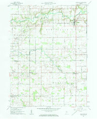
1961 · Burlington
USGS Topo · 1:24,000

1961 · Frankfort
USGS Topo · 1:24,000