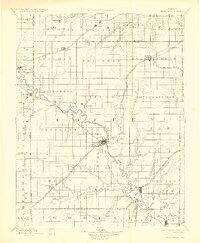
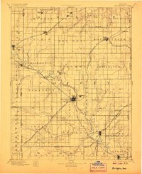
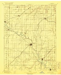
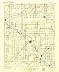
1894 Map of Burlington
USGS Topo · Published 1927About this map
The Neosho River meanders southeastward through this late-19th-century landscape, anchoring a series of settlements from Neosho Rapids down to Leroy and Neosho Falls. This era of development is defined by a dense network of competing rail lines, including the Kansas and Texas Div and the Lawrence and Burlington Br, which converge at the county seat of Burlington. North of the river, Marais des Cygnes Creek drains the agricultural townships of Arvonia and Olivet. Smaller communities like Lebo, Waverly, and Gridley are shown at their early railroad-era heights, while the map documents the original locations of rural landmarks such as Hampden and Strawn before 20th-century water management changed the local geography. The grid of section lines and township boundaries, including the Osage and Coffey county line, illustrates the systematic platting of the Kansas prairie.
Find a feature on this map
84 named features on this map. Tap any name to fly to it.
Don’t see what you’re looking for? This feature index may not catch every label — zoom into the map to look around manually.
Map Details
Editions of this 1894 Burlington Map
5 editions found

Other maps of this area

1885 · Eskridge
USGS Topo · 1:125,000

1885 · Burlington
USGS Topo · 1:125,000

1885 · Eureka
USGS Topo · 1:125,000

1885 · Garnett
USGS Topo · 1:125,000

1885 · Lawrence
USGS Topo · 1:125,000

1886 · Fredonia
USGS Topo · 1:125,000

1886 · Iola
USGS Topo · 1:125,000

1888 · Emporia
USGS Topo · 1:125,000

1888 · Eureka
USGS Topo · 1:125,000

1889 · Burlingame
USGS Topo · 1:125,000