
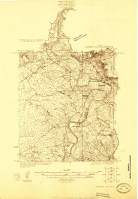
1925 Map of Burnet 3-b
USGS Topo · Published 1925About this map
Kingsland sits at the strategic confluence where the Llano River meets the Colorado River, serving as a central point in this 1925 survey. The landscape is defined by the significant elevation of Long Mountain and Backbone Mountain, which overlook the fertile bottomlands of Hoover Valley. This era captures the region's rural infrastructure before major modern hydrological changes, showcasing a network of small schoolhouses like the Long Mountain School and Pack Saddle School that once anchored these ranching communities.
Find a feature on this map
24 named features on this map. Tap any name to fly to it.
Don’t see what you’re looking for? This feature index may not catch every label — zoom into the map to look around manually.
Map Details
Editions of this 1925 Burnet 3-b Map
This is the sole edition of this map. No revisions or reprints were ever made.
Other maps of this area

1887 · Llano
USGS Topo · 1:125,000

1887 · Burnet
USGS Topo · 1:125,000

1893 · Burnet
USGS Topo · 1:125,000

1894 · Llano
USGS Topo · 1:125,000

1903 · Burnet
USGS Topo · 1:125,000

1904 · Llano
USGS Topo · 1:125,000

1909 · Llano
USGS Topo · 1:125,000

1909 · Burnet
USGS Topo · 1:125,000

1918 · Llano
USGS Topo · 1:125,000
1925 · Burnet 2-c
USGS Topo · 1:48,000