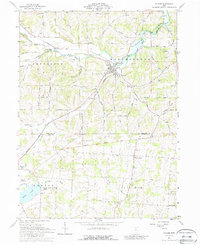
1961 Map of Butler
USGS Topo · Published 1988About this map
Butler sits at the heart of this 1961 landscape, where the Baltimore and Ohio railroad tracks trace the winding path of the Clear Fork Mohican River. The survey captures the transition from the village center to the outlying farmlands of Jefferson and Worthington townships, marked by a network of rural roads such as Wagner Road and Mishey Road. A significant historical boundary, the Greenville Treaty Line, cuts across the lower third of the map, separating Richland and Knox counties and anchoring the region's early settlement geometry.
Find a feature on this map
61 named features on this map. Tap any name to fly to it.
Don’t see what you’re looking for? This feature index may not catch every label — zoom into the map to look around manually.
Map Details
Editions of this 1961 Butler Map
4 editions found
Other maps of this area

1912 · Gambier
USGS Topo · 1:62,500

1912 · Perrysville
USGS Topo · 1:62,500

1914 · Gambier
USGS Topo · 1:62,500

1915 · Perrysville
USGS Topo · 1:62,500

1915 · Shauck
USGS Topo · 1:62,500

1915 · Fredericktown
USGS Topo · 1:62,500

1943 · Shauck
USGS Topo · 1:62,500

1943 · Gambier
USGS Topo · 1:62,500

1943 · Fredericktown
USGS Topo · 1:62,500

1944 · Perrysville
USGS Topo · 1:62,500