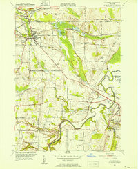
1950 Map of Caledonia
USGS Topo · Published 1952About this map
The Genesee River carves a winding path through this mid-century landscape where Livingston and Monroe counties meet. The area is defined by a dense intersection of rail infrastructure, including the Pennsylvania RR, Erie RR, and the Baltimore and Ohio RR, which converge near the village of Caledonia. This transportation network supported local industry, evidenced by the Quarry and Cement Plant Pond located between Caledonia and Mumford.
Find a feature on this map
66 named features on this map. Tap any name to fly to it.
Don’t see what you’re looking for? This feature index may not catch every label — zoom into the map to look around manually.
Map Details
Editions of this 1950 Caledonia Map
4 editions found
Other maps of this area

1895 · Rochester
USGS Topo · 1:62,500

1898 · Rochester
USGS Topo · 1:62,500

1899 · Brockport
USGS Topo · 1:62,500

1901 · Honeoye
USGS Topo · 1:62,500

1904 · Caledonia
USGS Topo · 1:62,500

1904 · Honeoye
USGS Topo · 1:62,500

1912 · Rochester
USGS Topo · 1:62,500

1920 · Rochester
USGS Topo · 1:62,500

1934 · Rush
USGS Topo · 1:24,000

1934 · Clifton
USGS Topo · 1:24,000