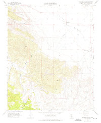
1966 Map of California Valley
USGS Topo · Published 1975About this map
The expansive Carrizo Plain dominates this mid-1960s survey, illustrating a remote portion of San Luis Obispo County during a period of planned development. The fledgling settlement of California Valley is visible on the eastern edge of the sheet, featuring a structured grid of roads and support infrastructure like the Fire Sta and California Valley Airfield. This land-use pattern contrasts sharply with the western terrain, where the elevation rises toward Freeborn Mountain and Hubbard Hill, carved by drainages such as San Juan Creek and Anderson Canyon.
Find a feature on this map
18 named features on this map. Tap any name to fly to it.
Don’t see what you’re looking for? This feature index may not catch every label — zoom into the map to look around manually.
Map Details
Editions of this 1966 California Valley Map
4 editions found
Other maps of this area

1912 · McKittrick
USGS Topo · 1:125,000

1932 · La Panza
USGS Topo · 1:48,000

1935 · La Panza
USGS Topo · 1:62,500

1936 · La Panza
USGS Topo · 1:62,500

1937 · Branch Mtn
USGS Topo · 1:48,000

1941 · Caliente Mountain
USGS Topo · 1:62,500

1942 · Branch Mountain
USGS Topo · 1:62,500

1942 · Caliente Mtn
USGS Topo · 1:62,500

1943 · Simmler
USGS Topo · 1:62,500

1943 · Caliente Mtn.
USGS Topo · 1:62,500