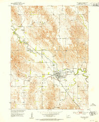
1951 Map of Callaway
USGS Topo · Published 1953About this map
Callaway serves as the central hub of this 1950s survey of Custer County, Nebraska, where the Union Pacific railroad follows the winding course of the South Loup River. The landscape is a study in early mid-century rural organization, defined by the townships of Triumph, Ryno, Delight, and Custer. This era reveals a dense network of country schools, including Evans Sch, Triumph Sch, and Whaley Sch, which highlight the distributed nature of the rural community before school consolidation took full effect.
Find a feature on this map
23 named features on this map. Tap any name to fly to it.
Don’t see what you’re looking for? This feature index may not catch every label — zoom into the map to look around manually.
Map Details
Editions of this 1951 Callaway Map
3 editions found
Other maps of this area

1951 · Callaway NW
USGS Topo · 1:24,000

1951 · Merna
USGS Topo · 1:24,000

1951 · Callaway SE
USGS Topo · 1:24,000

1951 · Callaway
USGS Topo · 1:24,000

1951 · Oconto NW
USGS Topo · 1:24,000

1951 · Oconto
USGS Topo · 1:24,000

1954 · North Platte
USGS Topo · 1:250,000

1955 · Broken Bow
USGS Topo · 1:250,000

1956 · Broken Bow
USGS Topo · 1:250,000

1956 · North Platte
USGS Topo · 1:250,000