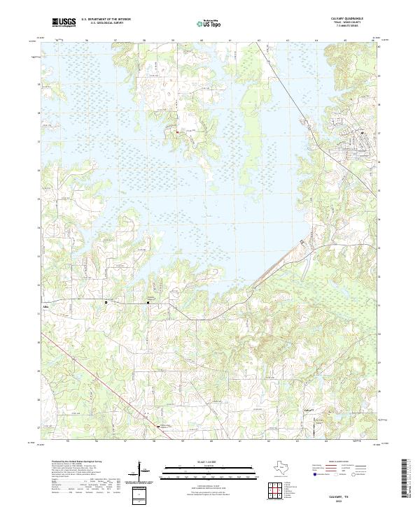
2022 Map of Calvary
USGS Topo · Published 2022About this map
The expansive waters of Case Lake and Taylor Lake dominate this Wood County landscape, illustrating the significant hydrological engineering that has reshaped the local drainage. Fed by tributaries such as Lake Fork Cr and Searcy Br, these large impoundments have transformed former creek bottoms into a vast aquatic network. For genealogists and local historians, several burial grounds remain preserved near the water's edge, including Searcy Cem near Indian Gap and Pleasant Ridge Cem south of the reservoir.
Find a feature on this map
99 named features on this map. Tap any name to fly to it.
Don’t see what you’re looking for? This feature index may not catch every label — zoom into the map to look around manually.
Map Details
Editions of this 2022 Calvary Map
This is the sole edition of this map. No revisions or reprints were ever made.
Other maps of this area

1956 · Tyler
USGS Topo · 1:250,000

1958 · Arbala
USGS Topo · 1:24,000

1958 · Alba
USGS Topo · 1:24,000

1959 · Calvary
USGS Topo · 1:24,000

1959 · Golden
USGS Topo · 1:24,000

1959 · Grand Saline
USGS Topo · 1:24,000

1959 · Yantis
USGS Topo · 1:24,000

1959 · Grand Saline
USGS Topo · 1:62,500

1959 · Alba
USGS Topo · 1:62,500

1960 · Mineola
USGS Topo · 1:24,000