
1967 Map of Calvin East
USGS Topo · Published 1968About this map
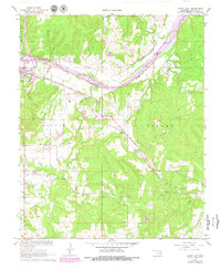
The Canadian River cuts through this portion of Hughes County, serving as a primary corridor for both natural drainage and transportation. The settlement of Calvin sits at a critical junction where the Chicago Rock Island and Pacific and Kansas Oklahoma and Gulf railroads converge near the riverbank. This intersection highlights the town's historical significance as a rail hub in the mid-20th century, supported by infrastructure like the nearby Gaging Station.
Find a feature on this map
20 named features on this map. Tap any name to fly to it.
Don’t see what you’re looking for? This feature index may not catch every label — zoom into the map to look around manually.
Map Details
Editions of this 1967 Calvin East Map
2 editions found
Other maps of this area

1896 · Coalgate
USGS Topo · 1:125,000

1899 · Coalgate
USGS Topo · 1:125,000

1900 · Wewoka
USGS Topo · 1:125,000

1900 · Coalgate
USGS Topo · 1:125,000

1954 · Oklahoma City
USGS Topo · 1:250,000

1957 · Ardmore
USGS Topo · 1:250,000

1957 · Oklahoma City
USGS Topo · 1:250,000

1963 · Ardmore
USGS Topo · 1:250,000

1963 · Oklahoma City
USGS Topo · 1:250,000
1967 · Ashland
USGS Topo · 1:24,000