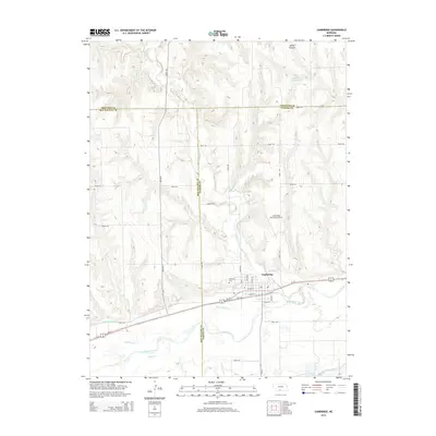
2014 Map of Cambridge
USGS Topo · Published 2014About this map
The town of Cambridge sits at the confluence of several watercourses in southwestern Nebraska, dominated by the path of the Republican River. This map shows the complex irrigation and drainage network vital to the region's agricultural character, including the Red Willow Canal and the Bartley Canal flowing south of the city. To the north, the landscape is defined by the winding paths of Medicine Cr and Little Medicine Cr, which carve through the terrain toward the river valley.
Find a feature on this map
35 named features on this map. Tap any name to fly to it.
Don’t see what you’re looking for? This feature index may not catch every label — zoom into the map to look around manually.
Map Details
Editions of this 2014 Cambridge Map
This is the sole edition of this map. No revisions or reprints were ever made.
Other maps of this area

1954 · McCook
USGS Topo · 1:250,000

1956 · Freedom
USGS Topo · 1:24,000

1956 · Cambridge
USGS Topo · 1:24,000

1956 · Medicine Creek Dam
USGS Topo · 1:24,000

1956 · Bartley
USGS Topo · 1:24,000

1957 · McCook
USGS Topo · 1:250,000

1957 · Danbury NE
USGS Topo · 1:24,000

1958 · McCook
USGS Topo · 1:250,000

1958 · Danbury NE
USGS Topo · 1:24,000
1958 · Wilsonville NW
USGS Topo · 1:24,000