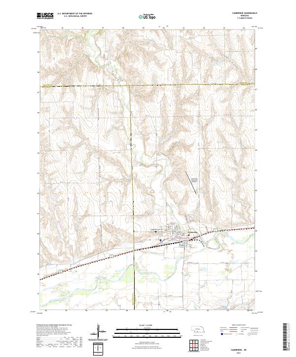
2021 Map of Cambridge
USGS Topo · Published 2021About this map
Cambridge serves as the focal point of this southwestern Nebraska landscape, situated at the confluence where Medicine Cr joins the Republican River. The town's grid is detailed with street names such as Niobrara St, Nevada St, and Nasby St, reflecting its established residential and commercial core. To the north, the terrain transitions into the dissected uplands of Smith Canyon and the drainages of Shelly Cr and Schuyler Cr, while the Cambridge Municipal Airport sits on the plateau overlooking the valley.
Find a feature on this map
43 named features on this map. Tap any name to fly to it.
Don’t see what you’re looking for? This feature index may not catch every label — zoom into the map to look around manually.
Map Details
Editions of this 2021 Cambridge Map
This is the sole edition of this map. No revisions or reprints were ever made.
Other maps of this area

1954 · McCook
USGS Topo · 1:250,000

1956 · Freedom
USGS Topo · 1:24,000

1956 · Cambridge
USGS Topo · 1:24,000

1956 · Medicine Creek Dam
USGS Topo · 1:24,000

1956 · Bartley
USGS Topo · 1:24,000

1957 · McCook
USGS Topo · 1:250,000

1957 · Danbury NE
USGS Topo · 1:24,000

1958 · McCook
USGS Topo · 1:250,000

1958 · Danbury NE
USGS Topo · 1:24,000
1958 · Wilsonville NW
USGS Topo · 1:24,000