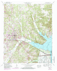
1950 Map of Camden
USGS Topo · Published 1985About this map
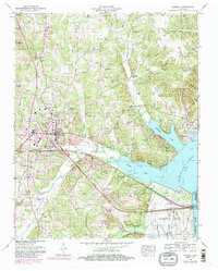
Camden serves as the focal point of this West Tennessee landscape, situated west of the expansive Kentucky Lake and the Tennessee River. The 1950 data, updated in the mid-1980s, reveals a rural infrastructure defined by small communities like Eva and Black Center, and a network of hollows such as Vick Hollow and Cat Hollow. The influence of the Tennessee Valley Authority is visible in the southern portion of the sheet, where a large Dewatering Area and a Pumping Station manage the water levels near Cypress Creek. Transportation is anchored by the Seaboard railroad line, which cuts through the southern terrain. For genealogists and local historians, the map is a dense record of community life, preserving the locations of numerous country churches and family burial grounds, including Bethlehem Cem, Blanchard Cem, and the Toll Chapel School.
Find a feature on this map
52 named features on this map. Tap any name to fly to it.
Don’t see what you’re looking for? This feature index may not catch every label — zoom into the map to look around manually.
Map Details
Editions of this 1950 Camden Map
6 editions found
Other maps of this area

1936 · Camden
USGS Topo · 1:24,000

1936 · Seventeen Creek
USGS Topo · 1:24,000

1936 · Big Sandy
USGS Topo · 1:24,000

1936 · Johnsonville
USGS Topo · 1:24,000

1936 · Bruceton
USGS Topo · 1:24,000

1936 · Harmon Creek
USGS Topo · 1:24,000

1936 · Rockport
USGS Topo · 1:24,000

1936 · Manleyville
USGS Topo · 1:24,000

1936 · Hustburg
USGS Topo · 1:24,000

1940 · Manleyville
USGS Topo · 1:24,000