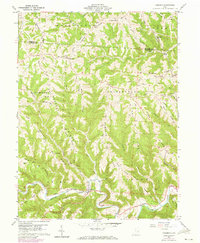
1960 Map of Cameron
USGS Topo · Published 1973About this map
Sunfish Creek carves a deep valley through the bottom of this 1960 Monroe County survey, defining the rugged township boundaries of Adams, Sunsbury, and Switzerland. The settlement of Cameron sits at the junction of the creek and Paine Run, while smaller communities like Switzer and Bingham are scattered across the high upland ridges. The topography is dominated by an intricate network of narrow, family-named divides, including Clover Ridge and Pumpkin Ridge, which dictate the winding paths of roads such as Headley Road and Ackerson Road.
Find a feature on this map
66 named features on this map. Tap any name to fly to it.
Don’t see what you’re looking for? This feature index may not catch every label — zoom into the map to look around manually.
Map Details
Editions of this 1960 Cameron Map
4 editions found
Other maps of this area

1905 · Clarington
USGS Topo · 1:62,500

1905 · New Matamoras
USGS Topo · 1:62,500

1905 · Woodsfield
USGS Topo · 1:62,500

1906 · New Martinsville
USGS Topo · 1:62,500

1924 · New Martinsville
USGS Topo · 1:62,500

1924 · New Matamoras
USGS Topo · 1:62,500

1926 · New Martinsville
USGS Topo · 1:62,500

1926 · New Matamoras
USGS Topo · 1:62,500

1935 · Clarington
USGS Topo · 1:62,500

1940 · Clarington
USGS Topo · 1:62,500