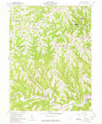
1960 Map of Cameron
USGS Topo · Published 1977About this map
Sunfish Creek carves a deep path through this section of Monroe County, where the landscape is defined by long, narrow ridges and the small communities that occupy them. The settlement of Cameron sits at the creek level, while upland life is clustered along named terrain features like Headley Ridge and Mellott Ridge. This survey captures a rural landscape heavily influenced by both resource extraction and faith, showing several Mines and numerous country sanctuaries, including Captina Ch, Bethel Ch, and Zion Ch. Genealogists will find a wealth of family-named burial sites such as Pugh Cem, Leibig Cem, and Hutter Cem. The presence of Oil Wells and a network of Pipelines running across the ridges indicates the industrial activity that shared the hillsides with these traditional Ohio farming communities in the mid-20th century.
Find a feature on this map
58 named features on this map. Tap any name to fly to it.
Don’t see what you’re looking for? This feature index may not catch every label — zoom into the map to look around manually.
Map Details
Editions of this 1960 Cameron Map
4 editions found
Other maps of this area

1905 · Clarington
USGS Topo · 1:62,500

1905 · New Matamoras
USGS Topo · 1:62,500

1905 · Woodsfield
USGS Topo · 1:62,500

1906 · New Martinsville
USGS Topo · 1:62,500

1924 · New Martinsville
USGS Topo · 1:62,500

1924 · New Matamoras
USGS Topo · 1:62,500

1926 · New Martinsville
USGS Topo · 1:62,500

1926 · New Matamoras
USGS Topo · 1:62,500

1935 · Clarington
USGS Topo · 1:62,500

1940 · Clarington
USGS Topo · 1:62,500