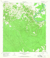
1960 Map of Camilla
USGS Topo · Published 1968About this map
The Trinity River snakes through the northeast corner of this 1960s survey, defining the eastern border of San Jacinto County against Polk County. The landscape is dominated by the dense canopy of the Sam Houston National Forest, which covers the central and southern portions of the quadrangle. Settlement is concentrated along the higher ground to the north, where small communities like Camilla and Rose Hill are situated. Cultural markers of the era include several country churches and burial grounds, such as Sweet Home Ch, Spring Ridge Ch, and the Ellis Cem.
Find a feature on this map
34 named features on this map. Tap any name to fly to it.
Don’t see what you’re looking for? This feature index may not catch every label — zoom into the map to look around manually.
Map Details
Editions of this 1960 Camilla Map
4 editions found
Other maps of this area

1943 · Liberty
USGS Topo · 1:125,000

1954 · Beaumont
USGS Topo · 1:250,000

1955 · Rayburn
USGS Topo · 1:62,500

1957 · Beaumont
USGS Topo · 1:250,000

1958 · Westcott
USGS Topo · 1:24,000

1958 · Livingston
USGS Topo · 1:62,500

1958 · Bear Creek
USGS Topo · 1:24,000

1960 · Blanchard
USGS Topo · 1:24,000

1960 · Stephen Creek
USGS Topo · 1:24,000

1960 · Camilla
USGS Topo · 1:24,000