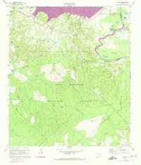
1960 Map of Camilla
USGS Topo · Published 1974About this map
Sam Houston National Forest dominates the southern landscape of this San Jacinto County region, where the terrain transitions from dense timberland to the winding Trinity River. The 1974 photorevision highlights a significant landscape transformation with the purple-shaded inundation zones of Lake Livingston creeping into the northern reaches. This era captures the area just as the reservoir began to alter local geography, yet it still preserves the locations of older community landmarks. Small settlements like Camilla and Rose Hill are documented alongside rural institutions such as Sweet Home Ch and Spring Ridge Ch. For those tracing local history, the map identifies several burial sites including Mitchell Cem and Rose Hill Cem, and notes the physical remnants of former industry through an Old Railroad Grade and a localized Gravel Pit.
Find a feature on this map
37 named features on this map. Tap any name to fly to it.
Don’t see what you’re looking for? This feature index may not catch every label — zoom into the map to look around manually.
Map Details
Editions of this 1960 Camilla Map
4 editions found
Other maps of this area

1943 · Liberty
USGS Topo · 1:125,000

1954 · Beaumont
USGS Topo · 1:250,000

1955 · Rayburn
USGS Topo · 1:62,500

1957 · Beaumont
USGS Topo · 1:250,000

1958 · Westcott
USGS Topo · 1:24,000

1958 · Livingston
USGS Topo · 1:62,500

1958 · Bear Creek
USGS Topo · 1:24,000

1960 · Blanchard
USGS Topo · 1:24,000

1960 · Stephen Creek
USGS Topo · 1:24,000

1960 · Camilla
USGS Topo · 1:24,000