
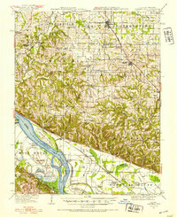
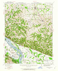
1916 Map of Campbell Hill
USGS Topo · Published 1953About this map
The Mississippi River defines the southwestern edge of this survey, winding past significant riverfront landmarks like Potato Bend and Bishop Landing. This 1916 landscape captures a transition from the rugged bluffs near Fountain Bluff to the established uplands of Jackson and Randolph Counties. Two major railroads, the St Louis Iron Mountain and Southern and the Mobile and Ohio, intersect the region, driving the growth of coal-mining and agricultural centers. Communities such as Willisville, Campbell Hill, and Ava appear at a time when the local economy was anchored by these rail corridors.
Find a feature on this map
82 named features on this map. Tap any name to fly to it.
Don’t see what you’re looking for? This feature index may not catch every label — zoom into the map to look around manually.
Map Details
Editions of this 1916 Campbell Hill Map
3 editions found
Other maps of this area

1910 · Murphysboro
USGS Topo · 1:62,500

1912 · Baldwin
USGS Topo · 1:62,500

1914 · Baldwin
USGS Topo · 1:62,500

1914 · Coulterville
USGS Topo · 1:62,500

1915 · Chester
USGS Topo · 1:62,500

1917 · Coulterville
USGS Topo · 1:62,500

1918 · Altenburg
USGS Topo · 1:62,500

1918 · Campbell Hill
USGS Topo · 1:62,500

1923 · Perryville
USGS Topo · 1:62,500

1924 · Perryville
USGS Topo · 1:62,500