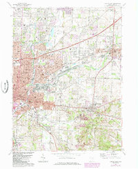
1967 Map of Canton East
USGS Topo · Published 1985About this map
Industrial and residential expansion defines the corridor between North Canton and Louisville during this mid-century period. The map illustrates a landscape transitioning from open fields to dense suburban blocks, particularly around the Canton Corp Bdy. Prominent educational and religious institutions serve as neighborhood anchors, including Walsh College, St Benedicts Sch, and the Santa Clara Monastery. This era shows the heavy influence of the Norfolk and Western and Conrail rail lines on the local economy, alongside municipal developments like the Sewage Disposal plant and numerous local schools such as Oakwood High Sch. The presence of the Santa Clara Monastery and various community churches like Trinity Ch provides a window into the social fabric of these growing Stark County communities before later 20th-century urban shifts.
Find a feature on this map
60 named features on this map. Tap any name to fly to it.
Don’t see what you’re looking for? This feature index may not catch every label — zoom into the map to look around manually.
Map Details
Editions of this 1967 Canton East Map
3 editions found
Other maps of this area

1901 · Canton
USGS Topo · 1:62,500

1903 · Canton
USGS Topo · 1:62,500

1909 · Alliance
USGS Topo · 1:62,500

1910 · Carrollton
USGS Topo · 1:62,500

1912 · Dover
USGS Topo · 1:62,500

1912 · Carrollton
USGS Topo · 1:62,500

1944 · Dover
USGS Topo · 1:62,500

1951 · Canton
USGS Topo · 1:250,000

1951 · Bolivar
USGS Topo · 1:24,000

1953 · Canton
USGS Topo · 1:250,000