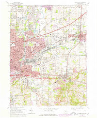
1967 Map of Canton East
USGS Topo · Published 1978About this map
Canton and its eastern industrial suburbs are documented here during a period of significant urban expansion and infrastructure development. The map details the convergence of the Middle Branch Nimishillen Creek and its sister branches, which historically shaped the development of neighborhoods like Fairhope and Pleasant View. Heavy rail lines, including the Penn Central and Norfolk and Western, dominate the corridor toward Louisville, reflecting the area's manufacturing strength.
Find a feature on this map
98 named features on this map. Tap any name to fly to it.
Don’t see what you’re looking for? This feature index may not catch every label — zoom into the map to look around manually.
Map Details
Editions of this 1967 Canton East Map
3 editions found
Other maps of this area

1901 · Canton
USGS Topo · 1:62,500

1903 · Canton
USGS Topo · 1:62,500

1909 · Alliance
USGS Topo · 1:62,500

1910 · Carrollton
USGS Topo · 1:62,500

1912 · Dover
USGS Topo · 1:62,500

1912 · Carrollton
USGS Topo · 1:62,500

1944 · Dover
USGS Topo · 1:62,500

1951 · Canton
USGS Topo · 1:250,000

1951 · Bolivar
USGS Topo · 1:24,000

1953 · Canton
USGS Topo · 1:250,000