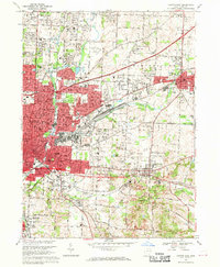
1967 Map of Canton East
USGS Topo · Published 1970About this map
Louisville and the eastern expansion of Canton define this mid-century portrait of Stark County, Ohio. The landscape is a mix of dense residential blocks and industrial infrastructure, where the Penn Central and Norfolk and Western railroads channel the region's manufacturing energy. Notable educational and religious landmarks are scattered throughout, from Walsh College in the north to the McKinley High School campus and St Louis Cemetery in the east.
Find a feature on this map
121 named features on this map. Tap any name to fly to it.
Don’t see what you’re looking for? This feature index may not catch every label — zoom into the map to look around manually.
Map Details
Editions of this 1967 Canton East Map
3 editions found
Other maps of this area

1901 · Canton
USGS Topo · 1:62,500

1903 · Canton
USGS Topo · 1:62,500

1909 · Alliance
USGS Topo · 1:62,500

1910 · Carrollton
USGS Topo · 1:62,500

1912 · Dover
USGS Topo · 1:62,500

1912 · Carrollton
USGS Topo · 1:62,500

1944 · Dover
USGS Topo · 1:62,500

1951 · Canton
USGS Topo · 1:250,000

1951 · Bolivar
USGS Topo · 1:24,000

1953 · Canton
USGS Topo · 1:250,000