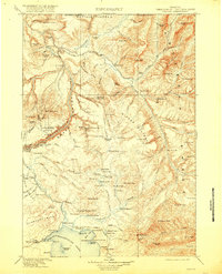
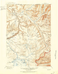
1911 Map of Canyon
USGS Topo · Published 1918About this map
Yellowstone National Park reveals its early twentieth-century character in this 1911 edition, documented by topographer Frank Tweedy. The landscape is defined by the massive thermal and geological features that earned the park its status, from the Fossil Forest and Petrified Trees to the active geothermal zones of the Crater Hills and numerous unnamed Hot Springs. Early hospitality and administrative hubs are established at the Canyon Hotel and Lake Hotel, while smaller outposts like Snowshoe Cabin and the Buffalo Farm reflect the operational needs of the park's formative years.
Find a feature on this map
138 named features on this map. Tap any name to fly to it.
Don’t see what you’re looking for? This feature index may not catch every label — zoom into the map to look around manually.
Map Details
Editions of this 1911 Canyon Map
6 editions found

Other maps of this area

1885 · Lake
USGS Topo · 1:125,000

1885 · Gallatin
USGS Topo · 1:125,000

1885 · Gallatin
USGS Topo · 1:125,000

1886 · Shoshone
USGS Topo · 1:125,000

1886 · Canyon
USGS Topo · 1:125,000

1888 · Shoshone
USGS Topo · 1:125,000

1891 · Livingston
USGS Topo · 1:250,000

1893 · Livingston
USGS Topo · 1:250,000

1893 · Ishawooa
USGS Topo · 1:125,000

1895 · Shoshone
USGS Topo · 1:125,000