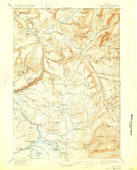
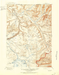
1911 Map of Canyon
USGS Topo · Published 1928About this map
Canyon Hotel and the Canyon Permanent Camp serve as primary landmarks in this 1910-era survey of the Wyoming wilderness. The landscape is defined by the high elevations of the Buffalo Plateau and the Mirror Plateau, where the Lamar River and Pelican Creek systems drain the mountainous interior. Geological curiosities are prominently noted, including the Fossil Forest on Specimen Ridge and the Petrified Trees near Yanceys.
Find a feature on this map
140 named features on this map. Tap any name to fly to it.
Don’t see what you’re looking for? This feature index may not catch every label — zoom into the map to look around manually.
Map Details
Editions of this 1911 Canyon Map
6 editions found

Other maps of this area

1885 · Lake
USGS Topo · 1:125,000

1885 · Gallatin
USGS Topo · 1:125,000

1885 · Gallatin
USGS Topo · 1:125,000

1886 · Shoshone
USGS Topo · 1:125,000

1886 · Canyon
USGS Topo · 1:125,000

1888 · Shoshone
USGS Topo · 1:125,000

1891 · Livingston
USGS Topo · 1:250,000

1893 · Livingston
USGS Topo · 1:250,000

1893 · Ishawooa
USGS Topo · 1:125,000

1895 · Shoshone
USGS Topo · 1:125,000