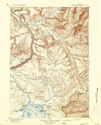
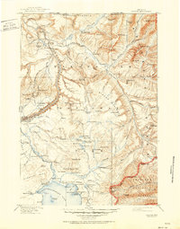
1911 Map of Canyon
USGS Topo · Published 1936About this map
The Lamar River and Yellowstone Lake serve as the primary anchors for this wilderness survey, based on work from the 1880s with revisions through 1910. Early tourism infrastructure is evident through established waypoints such as Yanceys, the Roosevelt Lodge, and the Canyon Hotel near the spectacular Lower Falls (308 feet). The map details a landscape of geological wonders and remote outposts, including the Buffalo Ranch on the Lamar River and various Snowshoe Cabins utilized for winter patrols. Strategic transit points like the Fishing Bridge and the Lake-Canyon Road illustrate the era's developing travel network. From the Absaroka Range in the east to the high Buffalo Plateau in the north, the terrain is marked by hydrothermal features like Turbid Sprs and the dense fossilized remains within the Fossil Forest.
Find a feature on this map
137 named features on this map. Tap any name to fly to it.
Don’t see what you’re looking for? This feature index may not catch every label — zoom into the map to look around manually.
Map Details
Editions of this 1911 Canyon Map
6 editions found

Other maps of this area

1885 · Lake
USGS Topo · 1:125,000

1885 · Gallatin
USGS Topo · 1:125,000

1885 · Gallatin
USGS Topo · 1:125,000

1886 · Shoshone
USGS Topo · 1:125,000

1886 · Canyon
USGS Topo · 1:125,000

1888 · Shoshone
USGS Topo · 1:125,000

1891 · Livingston
USGS Topo · 1:250,000

1893 · Livingston
USGS Topo · 1:250,000

1893 · Ishawooa
USGS Topo · 1:125,000

1895 · Shoshone
USGS Topo · 1:125,000