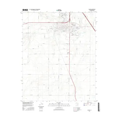
2016 Map of Canyon
USGS Topo · Published 2016About this map
W Texas A and M Univ serves as a major focal point in the city of Canyon, where the urban grid meets the creek-carved landscape of the Texas Panhandle. The city is situated at a natural hydrological junction where Palo Duro Cr and Tierra Blanca Cr converge, creating a complex drainage system that includes Dry Cr and Hackberry Cr. Beyond the main university campus and residential streets like Mable Dr and Conner Dr, the landscape transitions into agricultural and ranching land marked by smaller settlements such as Cleta and Dreamland. To the east, McSpadden Lake sits amidst the drainage plains, while local history is noted at the Cem located south of the main town center. The network of farm-to-market roads and numbered avenues reveals a community shaped by its proximity to both the university and the surrounding High Plains terrain.
Find a feature on this map
120 named features on this map. Tap any name to fly to it.
Don’t see what you’re looking for? This feature index may not catch every label — zoom into the map to look around manually.
Map Details
Editions of this 2016 Canyon Map
This is the sole edition of this map. No revisions or reprints were ever made.
Other maps of this area

1954 · Tucumcari
USGS Topo · 1:250,000

1954 · Amarillo
USGS Topo · 1:250,000

1954 · Plainview
USGS Topo · 1:250,000

1954 · Clovis
USGS Topo · 1:250,000

1958 · Clovis
USGS Topo · 1:250,000

1958 · Amarillo
USGS Topo · 1:250,000

1958 · Tucumcari
USGS Topo · 1:250,000

1958 · Plainview
USGS Topo · 1:250,000

1960 · Canyon
USGS Topo · 1:62,500

1960 · The Palisades
USGS Topo · 1:24,000