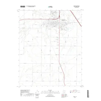
2019 Map of Canyon
USGS Topo · Published 2019About this map
The city of Canyon serves as the primary hub of this Randall County landscape, where the street grid of the urban center meets the erratic paths of High Plains waterways. The northern reach of the city is defined by the convergence of Palo Duro Creek and Tierra Blanca Cr, while the southern expanse transitions into rural agricultural land and smaller settlements like Cleta. The transport network radiates from the city center via Hereford Hwy and Russell Long Blvd, connecting the downtown Po and residential developments like Prairie View Dr to the surrounding prairie. Significant local landmarks include Dreamland Cem and several seasonal drainages such as Huckberry Cr and Dry Cr, which carve through the terrain and illustrate the drainage patterns that have historically shaped local settlement and land use.
Find a feature on this map
114 named features on this map. Tap any name to fly to it.
Don’t see what you’re looking for? This feature index may not catch every label — zoom into the map to look around manually.
Map Details
Editions of this 2019 Canyon Map
This is the sole edition of this map. No revisions or reprints were ever made.
Other maps of this area

1954 · Tucumcari
USGS Topo · 1:250,000

1954 · Amarillo
USGS Topo · 1:250,000

1954 · Plainview
USGS Topo · 1:250,000

1954 · Clovis
USGS Topo · 1:250,000

1958 · Clovis
USGS Topo · 1:250,000

1958 · Amarillo
USGS Topo · 1:250,000

1958 · Tucumcari
USGS Topo · 1:250,000

1958 · Plainview
USGS Topo · 1:250,000

1960 · Canyon
USGS Topo · 1:62,500

1960 · The Palisades
USGS Topo · 1:24,000