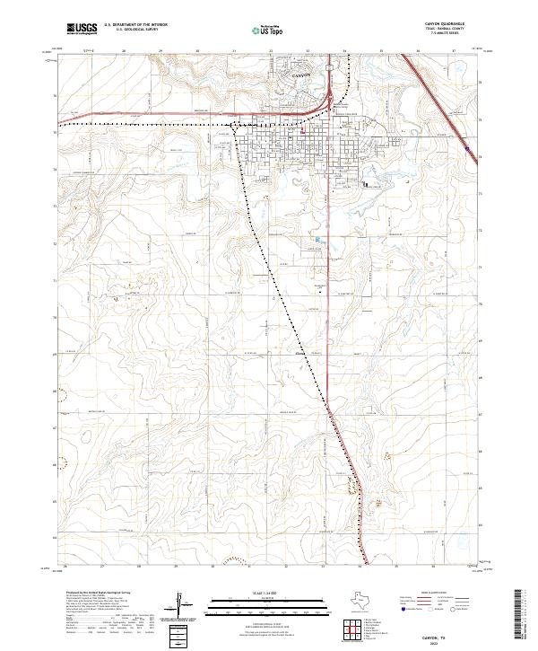
2022 Map of Canyon
USGS Topo · Published 2022About this map
Canyon serves as the focal point of this Panhandle landscape, where the confluence of Palo Duro Creek and Tierra Blanca Creek shapes the local topography. The town’s layout is defined by its educational and civic institutions, most notably the extensive campus of West Texas A and M University and the Randall County Justice Center. This modern survey illustrates the suburban expansion of the city, particularly in residential developments like Hunsley Hills Blvd and Canyon Rim Dr near the creek breaks.
Find a feature on this map
114 named features on this map. Tap any name to fly to it.
Don’t see what you’re looking for? This feature index may not catch every label — zoom into the map to look around manually.
Map Details
Editions of this 2022 Canyon Map
This is the sole edition of this map. No revisions or reprints were ever made.
Other maps of this area

1954 · Tucumcari
USGS Topo · 1:250,000

1954 · Amarillo
USGS Topo · 1:250,000

1954 · Plainview
USGS Topo · 1:250,000

1954 · Clovis
USGS Topo · 1:250,000

1958 · Clovis
USGS Topo · 1:250,000

1958 · Amarillo
USGS Topo · 1:250,000

1958 · Tucumcari
USGS Topo · 1:250,000

1958 · Plainview
USGS Topo · 1:250,000

1960 · Canyon
USGS Topo · 1:62,500

1960 · The Palisades
USGS Topo · 1:24,000