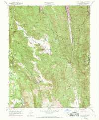
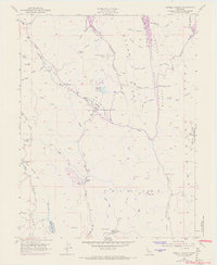
1951 Map of Capell Valley
USGS Topo · Published 1969About this map
Capell Valley and the surrounding high ridges of the Vaca Mountains define this landscape during the mid-century transition of Napa County. The 1951 field survey, with purple revisions from 1968, records the significant expansion of the Lake Berryessa Recreation Area in the northern reaches, showing where water began to reshape the old canyons. The map is a vital resource for tracing the rural infrastructure of the era, from the Asbestos mine tucked into a canyon below Wragg Ridge to the network of local schools serving isolated valley communities, including Capell Sch and Wooden Valley School. South of the Moskowite Reservoir and its spillway, the terrain drops toward the Milliken Reservoir and the family holdings of the Munson Ranch. Small settlements like Atlas and family landmarks like Rahey Rock provide specific points of interest for genealogists investigating the early development of these remote Napa highlands.
Find a feature on this map
31 named features on this map. Tap any name to fly to it.
Don’t see what you’re looking for? This feature index may not catch every label — zoom into the map to look around manually.
Map Details
Editions of this 1951 Capell Valley Map
5 editions found
Other maps of this area

1902 · Napa
USGS Topo · 1:125,000

1921 · Mt. Vaca
USGS Topo · 1:62,500

1924 · Capay
USGS Topo · 1:62,500

1942 · Sonoma
USGS Topo · 1:62,500

1942 · Mt. Vaca
USGS Topo · 1:62,500

1942 · St. Helena
USGS Topo · 1:62,500

1943 · Capay
USGS Topo · 1:62,500

1945 · Capay
USGS Topo · 1:62,500

1945 · St. Helena
USGS Topo · 1:62,500

1947 · Santa Rosa
USGS Topo · 1:250,000