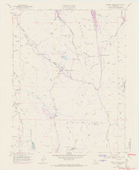
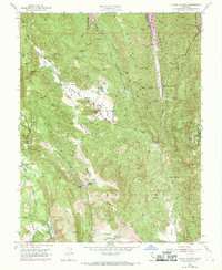
1951 Map of Capell Valley
USGS Topo · Published 1969About this map
Capell Valley and the surrounding eastern Napa County highlands are defined here by a network of ranching flats and narrow canyons between Wragg Ridge and the Vaca Mountains. The landscape reflects a mid-century period of transition, with traditional cattle operations like Munson Ranch and scattered rural schoolhouses such as Capell Sch and Wooden Valley School persisting even as water infrastructure transformed the region. The upper reaches of Lake Berryessa appear at the northeastern corner, while Moskowite Reservoir and Milliken Reservoir underscore the critical role of water storage in this terrain. Small-scale industrial history is marked by the Asbestos Mine near Steel Canyon, and an isolated Landing Strip provides a hint of increasing accessibility to these remote valleys. Along the western edge, the heights of Atlas and Red Mtn overlook the deeper canyons that drop toward the Napa Valley floor.
Find a feature on this map
55 named features on this map. Tap any name to fly to it.
Don’t see what you’re looking for? This feature index may not catch every label — zoom into the map to look around manually.
Map Details
Editions of this 1951 Capell Valley Map
5 editions found
Other maps of this area

1902 · Napa
USGS Topo · 1:125,000

1921 · Mt. Vaca
USGS Topo · 1:62,500

1924 · Capay
USGS Topo · 1:62,500

1942 · Sonoma
USGS Topo · 1:62,500

1942 · Mt. Vaca
USGS Topo · 1:62,500

1942 · St. Helena
USGS Topo · 1:62,500

1943 · Capay
USGS Topo · 1:62,500

1945 · Capay
USGS Topo · 1:62,500

1945 · St. Helena
USGS Topo · 1:62,500

1947 · Santa Rosa
USGS Topo · 1:250,000