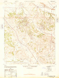
1947 Map of Careaga Canyon
USGS Topo · Published 1947About this map
Oil Fields dominate the central landscape of the Solomon Hills in this 1947 survey, illustrating the industrial footprint of petroleum extraction in Santa Barbara County. Small company towns and operations hubs like Roadamite and Palmer are clustered near the wells, connected by a network of unimproved roads and trails. To the north, the Sisquoc River valley supports agricultural activity near Sisquoc, where a Dismantled Railroad trace reflects the changing transportation needs of the era. The presence of local institutions like the Blochman School and Olive School among the rolling terrain indicates established rural communities. The map also documents resource extraction beyond oil, specifically at the Crushed Rock and Gravel Mine near the river, while the Los Alamos Valley provides a flat expanse to the south contrasted by the winding Careaga Canyon.
Find a feature on this map
25 named features on this map. Tap any name to fly to it.
Don’t see what you’re looking for? This feature index may not catch every label — zoom into the map to look around manually.
Map Details
Editions of this 1947 Careaga Canyon Map
3 editions found

Other maps of this area

1905 · Lompoc
USGS Topo · 1:125,000

1942 · Lompoc
USGS Topo · 1:125,000

1942 · Lompoc
USGS Topo · 1:62,500

1942 · Santa Maria
USGS Topo · 1:62,500

1942 · Tepusquet Peak
USGS Topo · 1:62,500

1942 · Los Olivos
USGS Topo · 1:62,500

1943 · Los Olivos
USGS Topo · 1:62,500

1943 · Tepusquet Peak
USGS Topo · 1:62,500

1943 · Lompoc
USGS Topo · 1:125,000

1947 · Lompoc
USGS Topo · 1:24,000