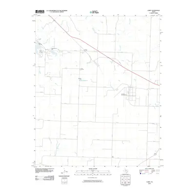
2010 Map of Carey
USGS Topo · Published 2010About this map
Carey sits at the heart of this Panhandle landscape, where the intersection of Us 287 and State Loop 328 marks the local hub of activity. The surrounding terrain is defined by a series of drainages and man-made water management features, including the Baylor Lake Dam and Lake Childress Dam to the northwest, and the Williams Dam which creates Williams Reservoir near the center of the sheet. These water sources are vital in this region, feeding into Baylor Creek, Grassy Creek, and Shores Creek.
Find a feature on this map
34 named features on this map. Tap any name to fly to it.
Don’t see what you’re looking for? This feature index may not catch every label — zoom into the map to look around manually.
Map Details
Editions of this 2010 Carey Map
This is the sole edition of this map. No revisions or reprints were ever made.
Other maps of this area

1954 · Plainview
USGS Topo · 1:250,000

1958 · Plainview
USGS Topo · 1:250,000

1960 · Loco
USGS Topo · 1:62,500

1961 · Estelline
USGS Topo · 1:62,500

1967 · Buckle L Ranch
USGS Topo · 1:24,000

1967 · Tell South
USGS Topo · 1:24,000

1967 · Hell Roaring Creek
USGS Topo · 1:24,000

1967 · Tell North
USGS Topo · 1:24,000

1967 · Childress
USGS Topo · 1:24,000

1967 · Carey
USGS Topo · 1:24,000