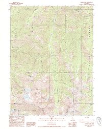
1986 Map of Caribou Lake
USGS Topo · Published 1986About this map
Salmon Mountains peaks and high-altitude basins dominate this corner of the California wilderness at the junction of the Klamath, Shasta, and Trinity National Forests. This mid-1980s survey captures a landscape of extreme relief, where the South Fork Salmon River and Caribou River carve through the Alps and Sawtooth Ridge. Traces of earlier resource extraction and early settlement appear at the Yellow Rose Mine and the remote Lakeview Ranch, which includes a small Cem nearby. The network of trails and gulches, such as Poorman Gulch and Swede Gulch, reflects a history of prospecting, evidenced by numerous Prospect markings. Recreational and pastoral uses are noted through the Big Flat Campground and Caribou Meadows, while the northern edge touches the small community of Adams.
Find a feature on this map
63 named features on this map. Tap any name to fly to it.
Don’t see what you’re looking for? This feature index may not catch every label — zoom into the map to look around manually.
Map Details
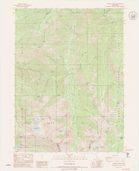
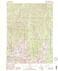
Editions of this 1986 Caribou Lake Map
3 editions found
Other maps of this area

1886 · Shasta
USGS Topo · 1:250,000

1890 · Red Bluff
USGS Topo · 1:250,000

1894 · Red Bluff
USGS Topo · 1:250,000

1894 · Shasta
USGS Topo · 1:250,000

1909 · Big Bar
USGS Topo · 1:96,000

1913 · Weaverville
USGS Topo · 1:125,000

1915 · Big Bar and Vicinity
USGS Topo · 1:250,000

1923 · Sawyers Bar
USGS Topo · 1:125,000

1931 · Etna
USGS Topo · 1:96,000

1934 · Etna
USGS Topo · 1:125,000